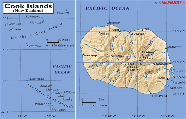
| Country (long form) |
Cook Islands |
| Capital |
Avarua |
| Area |
92.66 sq mi
240.00 sq km
(1.3 times the size of Washington, DC) |
| Population |
20,611 (July 2001 est.) |
Estimated population
in the year 2050 |
24,930 |
| Languages |
English (official), Maori |
| Literacy |
95% total; NA% male; NA% female |
| Religions |
Christian (majority of populace are members of the Cook Islands Christian Church) |
| Life Expectancy |
69.2 male, 73.1 female (2000 est.) |
| Government |
Self-governing parliamentary democracy |
| Currency |
1 New Zealand dollar (NZ$) = 100 cents |
| GDP (per capita) |
$5,000 (1999 est.) |
| Industry |
Fruit processing, tourism, fishing |
| Agriculture |
Copra, citrus, pineapples, tomatoes, beans, pawpaws, bananas, yams, taro, coffee; pigs |
| Arable Land |
9% |
| Minerals and Resources |
Negligible |
|
|